Showing posts with label manhole. Show all posts

Monday, January 12, 2026

Fossils & Smokestacks. Mine City


Mine, pronounced mee-nay, is located roughly in the middle of Yamaguchi Prefecture. Though called a city, with about 20,000 people spread over the area, it is really just a small town. It is now dominated by the quarry and cement plant of Mitsubishi Ube Cement Company.


Cement means limestone, and Mine sits on a large karst, a limestone plateau with numerous caves beneath it, including what is the largest cave in all of Japan.


Lots of fossils have been found beneath Mine, and fossils adorn the manhole covers, are the subject of a series of street sculptures, and fill the small but impressive Mine Fossil Museum which has a huge collection of Ammonites collected from all over the world among its collections.


There is also a Local History and Folklore Museum with collections that include fossils and skeletons of some of the ancient animals that roamed the area, as well as displays on the long history of mining in the area.


Copper has been mined here since ancient times, and was used in the construction of the Great Buddha in Nara.


In the Meiji Period coal began to be mined. At first it was used in the production of lime by burning limestone, but when it was discovered to be good quality anthracite, the Japanese Navy became interested. As I understand it, it was from the coal mines that most of the fossils were found.


The Navy operated the coal mines here and built the railway to take it to the coast, but eventually pulled out and the mines became privately owned again. During the 1930's and 1940's production was ramped up for the war effort. During the war many Korean labourers worked here and then allied POW's.


Production of coal continued after the war until the 1960's when the whole Japanese coal industry was closed down as the country shifted to cheaper oil.


Mine is now dominated by the open-cast limestone mine and associated cement plant. The two huge chimneys are visible long before you get to the town. I believe that a third has been added.


The mine started in 1947 and the cement factory in 1955. Initially, it was powered by coal but now uses "biomass". Though the main employer in the area, it never replaced the importance of the coal industry and the area continues to depopulate...


The last three photos show a small  Brutalist building, which offers me the opportunity for some abstract photography, and finally a public sculpture.


For those with an interest in geology and fossils, Mine would be worth a visit if nearby. There is a train station, though for several years the line has been closed and a replacement bus service is in operation.


The previous post in this series on day 26 of my walk along the Chugoku Kannon Pilgrimage was on a couple of interesting shrines I visited on my walk to Mine.


If you would like to subscribe by email just leave your email address in the comments below. It will not be published and made public. I post new content almost everyday, and send out an email about twice a month with short descriptions and links to the last ten posts.

Wednesday, July 16, 2025

To Mihara Castle Ruins


There is not a lot left of Mihara Castle, but what is left is somewhat striking.


I arrived in Mihara at the end of day 12 of my walk along the Chugoku Kannon Pilgrimage and took a ferry from Ikuchijima Island after having visited temple number 11 Kojoji, with its marvellous 15 century National Treasure pagoda.


Mihara is quite a busy little port with numerous ferries servicing the islands of the Inland Sea and even across to Shikoku. There is also some shipbuilding.


The castle was built in 1567 and greatly expanded over the following decades. It was built on a couple of small islands in the mouth of the Nuta River. At high tide it appeared to be floating on the sea and was known as the "floating castle".


The base for the tenshu is pretty much all that remains now, and it was built during expansion in 1595, though no tenshu was built. It was a pretty large cattle measuring 1 kilometer by 600 meters and had 14 gates and 32 yagura.


It was the easternmost fortification for the Mori Clan and the important Sanyodo highway passed through the outer fortifications.


In the Edo Period it was controlled by the Asano Clan since 1619 and was a branch castle of the Hiroshima Domain.


In the early Meiji Period most of the buildings were dismantled and sold as lumber. In 1894 with the construction of Mihara Station much of the stonework was taken away and used in the construction of Itozaki Port. Land reclamation moved the seashore further away and the final straw was the expansion of Mihara Station for the Shinkansen in 1975.


The previous post in this series on the Chugoku Pilgrimage was Kojoji Temple and its ancient pagoda.


Wednesday, December 13, 2023

Disappeared Japan Nagasaki Holland Village


Nagasaki Holland Village, built in 1983, was the predecessor to Huis Ten Bosch, the massive theme park at the northern end of Omura Bay in Nagasaki.


Nagasaki Holland Village, billed as a replica of Gouda and Hoorn, was mostly successful until the same company built the much bigger Huis Ten Bosch in 1992. It closed and was bought by the local authority, Seihi Town.


After spending a fortune renovating and maintaining it they leased it to a new company and it partially reopened but closed again in 2021 with very poor attendance.


With the company and the local authority in a legal battle over seemingly necessary repair work, it is very doubtful it will ever open again. 


I passed by on day 65 of my first walk around Kyushu. The previous post was the nearby Giant Torii. The previous Disappeared Japan post was the Yamane Residence.

Thursday, November 23, 2023

Togitsu Town


One of the benefits of walking everywhere rather than using a faster method of travel is that you get to see things you would miss if you were in a hurry. You get to see many of the "boring places" thta you would normally avoid.


Heading north out of Nagasaki I had to pass through Togitsu. In essence it is really just a suburb of Nagasaki now and seems to be composed of the multitude of national chain businesses that cover the country.


However, the draincovers of the town showed an intriguing rock formation, a spire of rock with what appears to be a boulder perched precariously on top. The rock was previously known as Tsugi ishi bozu but is now more commonly referred to as Sabaku Sarakashi Ishi after a well known story.


According bto the story a mackerel seller was coming down the road with a basket full of mackerel to sell but when he saw the rock her decided it looked like it was about to fall off the spire of rock so he decide to wait until it did before passing on safely. The rock never did fall and all his fish rotted leading to a variety of "the moral of the story is....."


Not far from the rock was a very large mansion-type building. It is called a tea-house but was in fact one of the buildings making up a honjin, a residence for lords while they are travelling.


It is said that the hinjin was originally about twice the size of the remaining building. Unfortunateky it was not open to the public.


Nearby, Togitsu Town Hall had a statue in front that I felt must surely refer to a local myth or legend, but apparently not. It is titled "Fureai", which is a world of recent origin that refers to a kind of feeling of solidarity between different members of a community. It seems to have appeared in the 1970's after modern Japan's social structure had altered from what had been traditional.


The previous post in this series on day 64 of my first walk around Kyushu was the diary of day 63.

Friday, July 21, 2023

Decorative Manholes from Fukuoka, North Kyushu


Giravanz is the local soccer team in Kitakyushu that lay at the stadium in Kokura. Their mascot is a seagull named Wavy.


Matsu Beach is on a long sweeping bay in Okagaki Town in the Onga District. It is known for a long cycle path through the pines that grow along the beach.


Tagawa was a former coal-mining town whose two remaining brick chimneys are symbols of the town.


These last two were  both found in Kokura, though I have seen them popping up all over Japan, manholes depicting characters from Pokemon. I know almost nothing about Pokemon, though I believe these manholes are connected to Pokemn-Go, a smartphone game.


The previous post in the series was Saga Manholes.

Wednesday, January 4, 2023

Saga Manholes

Saga Manholes

Saga Manholes.

While walking from Kurume to Saga on day 56 of my walk along the Kyushu pilgrimage I took snaps of any manhole covers I encountered. This first is of Yoshinogari Historical park which I passed by. It is a huge archeological site, claimed, without much evidence, as the site of the famed Queen Himiko's palace  town. There are dozens and dozens of reconstructed kofun era and Yayoi era buildings.

Saga Manholes.

Before reaching Yoshinogari I walked through Miyaki, which is both a district and a town and therefore covers quite a large area. This first one seems to have daffodils.

Drainspotting.

The Miyaki Town website features photos of Lotus blossoms, so I am guessing that is what is on this second design. The town extends up into the mountains so I am guessing the observation deck is from there.

Drainspotting.

In Saga City, many of the manholes feature Mudskippers, the curious-looking fish that spend much of their time out of water in the mudflats of the Ariake Sea. Once eaten almost to extinction, they are now protected and have made a comeback.

Drain cover in Saga.

The vast majority of manhole covers in Japan are for water and drainage, with a few electric, and as seen here a few for gas. Only bigger cities have mains gas, most of us use lpg tanks that arevdelivered.
Obviously, from the design, Saga City used gas for streetlighting, probably in the early Meiji era.

Brain drain.

Wednesday, November 2, 2022

Amagi to Tosu. Day 55 Walking Around Kyushu

Saturday, January 4th 2014

It's still dark when I leave my hotel and walk to Kurume Station. I take a train north across the river towards Amagi where I will continue my pilgrimage, but first, get off after a couple of stops at Kitano Station. A few hundred meters from the station is a shrine I want to visit, a branch of Kitano Tenmangu, the first shrine to Sugawara Michizane in Kyoto.


Amagi to Tosu.

 The village here is called Kitano after the shrine's name. That is not unusual, many places in Japan are named after the local shrine or temple. It is quite a big shrine and has a single statue of a white horse, fairly common at shrines, but also has three orange horses,... quite unusual. The walls of the corridors of the shrine are covered with examples of calligraphy, something the Kami Tenjin, the enshrined spirit of Michizane, is known for.


 I jumped back on a train to the last station of the line, Amagi, and when I arrive the sun is up promising another fine day. I had some trouble finding the first pilgrimage temple of the day, Kotokuin,number 7 in the order they are listed. It was located in a suburban area a little north of the station but was not a large temple with a typical large curved roof, but a small single-storey building, so I could not see it from a distance. I asked several passers-by but had no luck. Often in Japan if a place is not famous then even people who live nearby will not know where it is. I find it eventually and there 
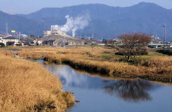
is not much to see. My route now heads west across the wide plain. 


Japan is often characterized as being a mountainous country, and while that is true, there are plenty of wide-open flat areas, this being one of them. While I haven't yet traveled in many parts of Japan, so far in my experience Kyushu seems to have a lot of these flat areas. It is of course mostly farmland, and several times I pass near huge structure with silos. The fields and paddies are also interspersed with small settlements, marked by trees, the largest of the trees often indicate a shrine, none of the ones I visited had any visitors though. The shrines I visited were  Ushiki Tenmangu, Nomachi Takano, Shisojima Tenmangu, Otoguma Tenmangu, and Yokoguma Hayabusataka.


 By lunchtime, it is becoming more urban and I reach temple number 3, Nyoirinji, and it is very busy. It's not a very big temple but is obviously very popular. The most noticeable thing is a large number of frog statues. They are everywhere. In the car park are a line of large metal ones covered in what appears to be graffiti, but what is in fact prayers and wishes. I had hoped to meet with the head priest of the temple, the father of the young priest I had met at temple number 93 some 53 walking days ago, but he was obviously very busy. The grounds did have a nice walk with many fines statues so I leisurely explored before heading off. 


I headed south, now into urban Ogori, and walked parallel to several train lines as well as the main road and expressway. There were several larger shrines to stop at and explore, Rikitake Kamado, Misetaireiseki,  and Ogori Susano. I pass under the East-West expressway and turn west parallel to it.  At a big shrine I am surprised to find many statues of monkeys, not the Three Wise Monkeys, but mostly mother monkeys in red hats holding baby monkeys. It's a Hiyoshi Shrine, a branch of the famous shrine at the base of Mount Hiei whose guardian animal is the monkey.


 In Tashiro I find the last pilgrimage temple of the day, Fudo-in, number 4. It took some finding as it is a small concrete structure in the middle of a crowded suburban area. Nothing much to see except for a nice statue of Fudo Myo O, the temple's namesake. It's now getting late and I head south back toward Kurume. I get as far as Tosu before deciding to call it a day


As usual, I took photos of the many unique manhole covers I saw along the way.

Japan Shop